Today into early Wednesday will have some light to moderate rainfall.
The heaviest rainfall will be along the I-70 corridor in Ohio, with less as you go further north and south. I have already picked up .2" of rain as I type this. Rain is expected to continue as the day progresses. As the low pressure system moves out of the Ohio Valley and towards the east coast, rainfall will slowly end, probably around the early morning tomorrow.
Thankfully, this rain will end early enough for a beautiful Thanksgiving day. It won't be very warm, with temperatures in the upper 40s to low 50s, but temperatures will rise a bit more on Friday, leading up to a nice start to the weekend.
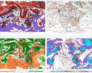
However, this is where the tough part of the forecast will be. The global models are all predicting a storm to move up west of here into the midwest, leading to rising temperatures and rainfall during late Saturday. What happens after that is up for grabs. The GFS has consistently closed off the 500mb low, leading to a cold air shortage, with temperatures in the low 40s in Indiana/Ohio, while temperatures in northern Alabama ending colder than us! There are already significant differences within the first 72 hours between the GFS and other models, so unless other models start to do that, it remains an outlier at the time.
Another model to look at is the GGEM.
Yesterday, it also cut off the 500mb low, although in a different position than the GFS. Today's 12z run leaves the s/w in the west behind, leading to a northern stream only solution. However, it holds back some energy, and it eventually rounds the base of the trough, leading to a storm up eastern Ohio. This would be a decent snowfall event for western Ohio and parts of MI if taken verbatim. However, inconsistency remains a big issue.
The remaining models left are the UKMET and ECMWF. The UKMET has had some troubles in the long range, but is actually in second place, trailing the ECMWF on verification scores in the last month. Both the UKMET and ECMWF have a secondary low pressure system developing in the southeast US, but both have some differences in timing placement. The ECM showed over 6" of snow for some people in Ohio on yesterday's 12z run, than didn't do much on the 0z run. The 12z cycle is coming out soon, so I may go back and edit this post in an hour or so.
Hopefully by Thanksgiving we will have a better idea of what's going on. Right now I can't do much other than speculate that this could be a snow producer for some areas in the South/Central Great Lakes, but things could change rather rapidly. Until we get into the short range, the plot can only thicken. Stay tuned to the Ohio/Ontario/Michigan Weather Blog for More information on this storm and many others to come through the winter.
Happy Thanksgiving everyone!


No comments:
Post a Comment
Comments are now being filtered due to Blogger receiving an increasing amount of spam. If you have any type of blogger ID, your comment will be posted. I apologize for any inconvenience